Top 10 Best Hiking Trails in Singapore You Didn’t Know Existed
If you’re looking for a breathtaking view and some exercise, check out these top 10 hiking trails in Singapore. From jungle treks to coastal walks, there’s something for everyone. Just be sure to wear sunscreen and insect repellent, and pack plenty of water!

Table of Contents
#1 – The Southern Ridges
Introduction:
Go on a hike in the great outdoors and enjoy the serenity on offer at the Southern Ridges. Comprising 10 km of green, open spaces that connect Mount Faber Park, Telok Blangah Hill Park, HortPark, Kent Ridge Park and Labrador Nature Reserve, these ridges are an alternative for walking enthusiasts, history buffs, shutterbugs, nature lovers, bird watchers and families looking for a different kind of family outing.
Steeped in history and one of the best spots in Singapore to enjoy panoramic views of the city, harbour and the Southern Islands, the Southern Ridges is home to a wide variety of flora and fauna.
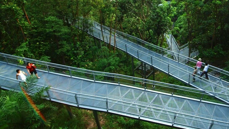
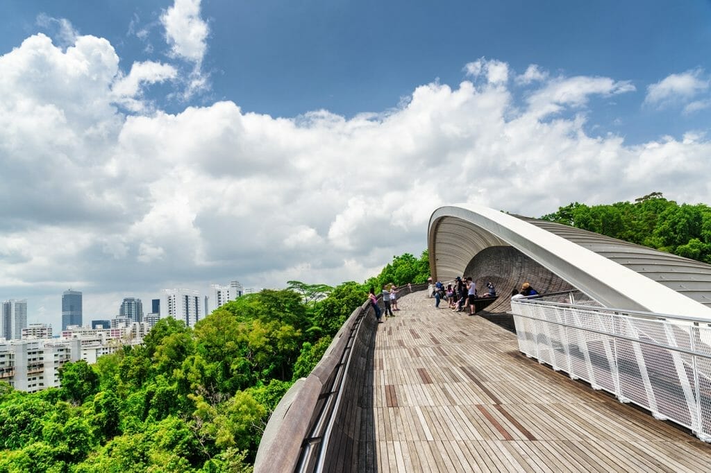
Henderson Waves, a structure not to be missed, connects Mount Faber Park to Telok Blangah Hill Park. Standing 36 metres above Henderson Road, it is the highest pedestrian bridge in Singapore, and is frequently visited for its artistic, distinctive wave-like structure consisting of a series of undulating curved ‘ribs’. Other highlights of the Southern Ridges include the Forest Walk and Canopy Walk – bridges cutting through the Adinandra Belukar, a distinct type of secondary forest. Here, you can see a rich variety of flora and fauna and observe birds in their natural habitat. Walk on the Ridges and capture the beauty of wild flowers and birds. Explore Berlayer Creek at the newly launched Labrador Nature and Coastal Walk, which is home to myriad flora and fauna, another great getaway from the hustle and bustle of city life.
Reviews (from Tripadvisor):
Andy C
Very cool and unique 5K hike
Great hike from Henderson Waves (Mount Faber) to Kent Ridge across metal walkways and treetops. I would skip this hike during rain because the metal walkways get very slippery, and being surrounded by all metal in the treetops probably isn’t safe in a thunderstorm, but otherwise it’s a very pleasant and scenic height. If you go from end to end, it’s approximately 5k (including the Canopy Walk at Kent Ridge).
Opening Hours:
- Lighting hours for Alexandra Arch: changing LED lights: 7 pm – 12 am daily
- Lighting hours for Forest Walk: 7 pm – 7 am daily
- Lighting hours for Henderson Waves: 7 pm – 7 am daily
- Safety LED lights on bridges: 7 pm – 7 am daily
Price of Admission: Free admission
Location & Address: Kent Ridge Park and Telok Blangah Hill Park, Singapore
Contact: 1800 471 7300
Website: Website Link Here
#2 – Bukit Timah Nature Reserve
Introduction:
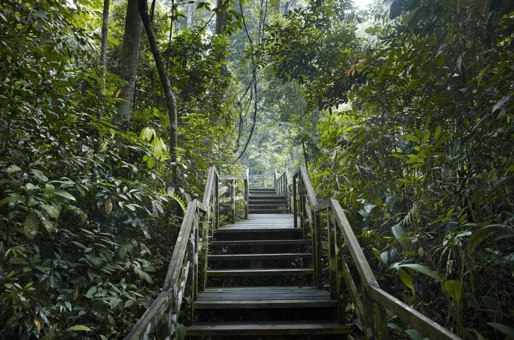
Experience nature in its pristine form at Bukit Timah Nature Reserve, which is a mere 12 km from the bustling city centre. By virtue of Singapore’s location on the equatorial belt, the reserve has one of the richest and most diverse ecological systems. Visitors will see an astonishing variety of plant, animal and insect life, typical of a humid equatorial climate.
This 163-ha reserve includes Singapore’s highest hill, Bukit Timah Hill, which stands at 163 m and retains one of the few areas of primary rainforest in the country. The forest on the hill has been a botanical collection ground for more than a century, and the first known specimens of many species of Malayan plants have been obtained here.
Home to a high percentage of our nation’s (native) flora and fauna, Bukit Timah Nature Reserve has been a favourite spot for those looking to get close to nature. Some of these flora and fauna species include the Seraya (Shorea curtisii), Red Dhup (Parishia insignis), Greater Racket-tailed Drongo (Dicrurus paradiseus) and Malayan Colugo (Galeopterus variegatus).
Established in 1883, Bukit Timah Forest Reserve was one of the first forest reserves to be created in Singapore, as recommended by Nathaniel Cantley, the then Superintendent of the Singapore Botanic Gardens. In 1882, Cantley was commissioned by the government of the Straits Settlements to prepare a report on the forests of the settlements. In his report, he recommended for several forest reserves to be created on the island, which were established over the next few years.
However, all the reserves, except for Bukit Timah Forest Reserve, were worked for timber. By 1937, most of these reserves had been depleted due to economic development. Thankfully, Bukit Timah Forest Reserve was retained for the protection of its flora and fauna under the management of the Singapore Botanic Gardens.
Reviews (from Tripadvisor)
Andy C
One of the best MTB trails and hiking areas in Singapore.
One of the best parks in Singapore. The MTB trails are top 3 in Singapore. They are fairly technical so it would be advisable to start on less difficult terrain if you’re new to MTB (maybe Chestnut South). The hike to the summit on walking trail is great. It’s steep and it’s very smart that Singapore doesn’t allow bicycles. That could be disastrous. The stairs are also pretty steep at the top for the final climb to the radio towers on top. It’s worth the trip up there. You can access from the parking area right at Bukit Tima, or from the Dairy Farm parking area off BKE. Check before you drive there. The parking area at Bukit Tima is often closed due to COVID restrictions. I guess the cars in the parking area could spread COVID if allowed to park there. 🙄
Opening Hours:
Nature Reserve Opening Hours
7am to 7pm daily (entering or remaining in the nature reserve after 7pm is not allowed)
Exhibition Hall Opening Hours
8am to 5.30pm daily
Carpark Opening Hours
7am to 7pm daily
Price of Admission: Free Admission
Location & Address: Hindhede Dr, Singapore 589318
Contact: 1800 471 7300
Website: Website Link Here
#3 – Faber Peak
Introduction:
Home of the Singapore Cable Car, an iconic symbol since 1974, Mount Faber Peak is the only hilltop destination in Singapore with breathtaking scenic views of the harbour, Sentosa and the Singapore skyline. Surrounded by lush greenery and tucked away from the hustle and bustle of the city, Mount Faber Peak offers an elegant respite at 100 metres above sea level. Visitors looking to get close to nature can also venture up to Mount Faber Park for a breath of fresh air, immersing themselves in the rustic surroundings of one of Singapore’s oldest parks. A treasure trove of experiences awaits at Mount Faber Peak – from spectacular hilltop views to a suite of leisure, lifestyle and F&B services.
Reviews (Tripadvisor):
Grover R
The Peak of Happiness, you won’t want to miss
Don’t just take the cable car to Sentosa, take the full ride you paid for and visit Faber Peak. From here you can go to the top or walk the Southern Ridges to the Henderson Wave. However just outside the cable car station is one of the more unusual attractions, the Polish Bells of Happiness. We not only rang the bells, we left our own bells with our own message at the top. Plus you get an awesome view over to Sentosa Island. Simply, don’t overlook the ride to Faber Peak. There is much to see and do. Plus it will be the Peak of Happiness on your trip.
Opening Hours:
- 8:45 AM – 9:30 PM Daily
Price of Admission: Cable Car Sky Pass (Mount Faber + Sentosa Line)
Adult: $28.00
Child: $20.00
Location & Address:
Contact: +65 6361 0088
Website: Website Link Here
#4 – Dairy Farm Nature Park
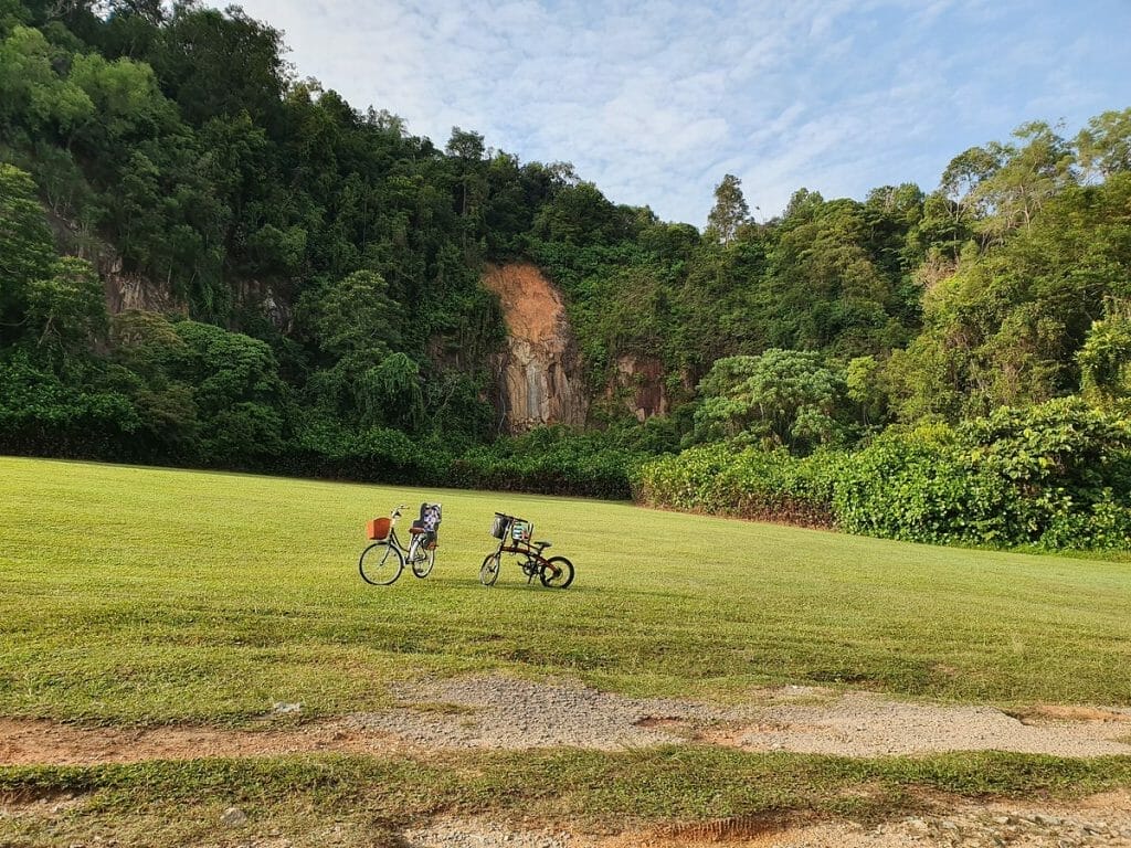
Introduction: Set in a rustic environment with multiple trails for hiking and biking, the 75-hectare Dairy Farm Nature Park offers a host of recreational activities and amenities such as a nature trail and former quarry. The park is known for the Wallace Education Centre which features a permanent exhibition on the renowned English naturalist Alfred Russel Wallace to honour his contributions to natural science. Arriving on 18 April 1854, Wallace used Singapore as a base to study the natural history of the Malay Archipelago for eight years. A contemporary of Charles Darwin, Wallace is the other “father” behind the theory of evolution.
Reviews (Tripadvisor):
Kim Buay P
Trail covering both Diary Farm quarry and Singapore Quarry
Service 700 will no longer be available after 29 August. I enjoyed the smooth ride on this bus from Raffles Town Club bus stop and alighted at a bus stop across the road from Dairy Farm carpark B. There are many trails available at Dairy farm nature Park. On this trip, I walked towards Dairy Farm Quarry using a scenic route with vegetation on both sides. There are maps along the way to guide and Dairy farm Quarry is such a joyful destination. It comprises of a big field suitable for a picnic and for all kinds of sporting games among friends. Another 1.3 km away is the Singapore Quarry and so it is a good idea to cover both quarries in one trip.
Opening Hours:
Nature Park Opening Hours
7am to 7pm daily (entering or remaining in the park after 7pm is not allowed)
Price of Admission: Free Admission
Location & Address: 100 Dairy Farm Rd, Singapore 679057
Contact: 1800 471 7300
Website: Website Link Here
#5 – Night Safari Wallaby Trail
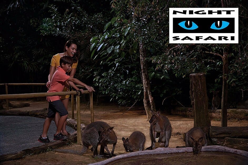
Introduction: This trail brings you down under to the natural wonders and wildlife of Australia, New Zealand and New Guinea. Set off from the rustic Discovery Station to meet marsupials such as the sugar glider and brush-tailed possum. Listen out for the morepork owl, named for its melancholic “more-pork” call.
Reviews (from Tripadvisor):
Carine L
Very good surprise!
It’s an activity to do in couple or family. I didn’t expected to approach so nearly the animals. It’s really like you are in a safari because animals are not in cage, they looks like in their own natural habitat. We really appreciated our tour. Only negative point is the tour car are very too noisy and sometimes it looks like a attraction show with musics and voices comments.
Opening Hours:
- 6.30pm to 12am (Last entry at 11.15pm) Daily
Price of Admission:
Adult: $55
Child: $38
Senior: $20
Location & Address: 80 Mandai Lake Rd, Singapore 729826
Contact: +65 6269 3411
Website: Website Link Here
#6 – Kallang Park Connector
Introduction:
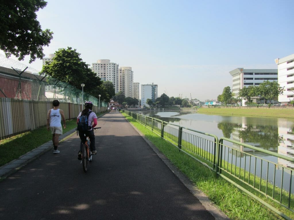
Stretching along the Kallang River, the Kallang Park Connector links Bishan-Ang Mo Kio Park to Kallang Riverside Park where you have the chance to see foraging birds, monitor lizards and squirrels along the riverbank. It takes you through several residential estates in the Central region – Bishan, Toa Payoh, Potong Pasir, Serangoon, Bendemeer, Upper Boon Keng and Kallang.
Enjoy the lush greenery at Kolam Ayer Waterfront, part of PUB’s Active, Beautiful, Clean Waters programme, along Kallang River. This park connector also meets Whampoa Park Connector from Bendemeer Road, providing you with easy accessibility to Toa Payoh Town Park.
Reviews (from Tripadvisor)
Kim Buay P
A park Connector which links Bishan-Ang Mo Kio Park to Kallang Riverside Park
Kallang PC starts at Bishan Road and runs along Kallang River before ending at Sims Avenue. It connects Bishan-Ang Mo Kio Park to Kallang Riverside Park. A walk here includes passing through several residential estates in the Central region – Bishan, Toa Payoh, Potong Pasir, Serangoon, Bendemeer, Upper Boon Keng and Kallang.
Part of the connector includes the lush greenery at Kolam Ayer Waterfront, part of PUB’s Active, Beautiful, Clean Waters programme, along Kallang River. This park connector also meets Whampoa Park Connector from Bendemeer Road, providing easy accessibility to Toa Payoh Town Park.
Cyclists should take note that the overhead bridge to cross the PIE does not include a ramp. Other overhead bridges along the way which have only steps can be avoided by crossing at the traffic lights. It is 7.87 km long. The most scenic stretch is near to Potong Pasir.
Opening Hours:
Opening Hours: 24hours daily
Lighting Hours: 7.00pm – 7.00am
Price of Admission: Free Admission
Location & Address: 998 Bendemeer Rd, Singapore 339945
Contact: NA
Website: Website Link Here
_
Read Also:
Top 25 Best Cycling Routes and Nature Trails in Singapore
#7 – The Old Jurong Railway Line Trail
Introduction:
From Jurong East MRT, hike along Jurong Town Hall Road towards Teban Flyover. Turn left and follow the hiking route towards Jurong Circular Bridge. As of June 2019, a section of the route is under construction; walk along the unpaved path.
Cross the railway bridge and enter Ulu Pandan Park Connector. Walk along the canal till you reach Commonwealth Avenue highway. A section of the railway track can be found up the slope.
From there, continue along the canal to the underside of Clementi Avenue 6 highway. A longer, more complete section of the railway track can be found.
Continue along the park connector and cross the pedestrian bridge to the other side of the canal. Have a quick rest stop at Sunset Way.
Reviews (from Tripadvisor):
Kim Buay P
Tracing the tracks of old Jurong Railway Line
As Jurong Industrial Estate grew steadily in the late 1960s, the Economic Development Board (EDB) worked with Keretapi Tanah Melayu (KTM, Malayan Railways Limited) to develop Jurong Railway Line. The Jurong line branched off from the main Malaysia-Singapore railway at the Bukit Timah Railway Station next to King Albert Park.
The Jurong Line ran through Sunset Way estate and ended at Shipyard Road, near the Mobil refinery. The Jurong Railway ceased operations in the mid-1990s as a result of efficient road transportation network.
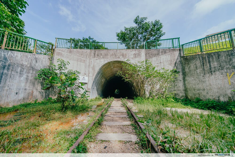
I started my walk at the bus stop”opp Maju Camp” where there is the first underground tunnel. It has been cleaned up and restored. It is possible to hike the along the former rusting track through the Maju Forest and ends up at Clementi Street 14 at Sunset Way where is a a girder bridge across the road. Alternatively can take a bus two bus stops away to Sunset Way to continue the trail if hiking through the Maju forest is not your cup of tea. Slighter further up is the outstanding truss bridge over Sungei Ulu Pandan. Both bridges are now out of bounds to the public. However there is an easy path from Ulu Pandan Park Connector near to the truss bridge to access the elevated old tracks in between both bridges.
Walking across the pedestrian bridge over the river, I soon traced back the old rusting track near to Blk 301( easily accessible from park connector by a flight of stairs ) and 305 in Clementi.
The track stopped at the BTO Clementi NorthArc (near Clementi Ave 6) and so we went down a small slope to continue walking along the park connector. At Commonwealth Ave West, we went up a small slope again and we saw the old tracks again. It disappears near Faber Heights. We can access the park connector again by walking along Faber Heights. At the end of the park connector, the only trace of the track was the bridge alongside AYE as it crossed the Sungei Ulu Pandan once again. This bridge is now converted into a pedestrian bridge to link Ulu Pandan Park Connector to Pandan Gardens Park Connector.
We took a bus to Teban Gardens to look at the other tunnel under the Jurong Town Hall Road. This tunnel has not been cleaned up and it is dark and muddy. It is next to the open field at Teban Gardens.
Opening Hours:
- 24 hours Daily
Price of Admission: Free Admission
Location & Address: 48 Sunset Way, Singapore 597074
Contact: NA
Website: Website Link Here
#8 – Whampoa Park Connector
Introduction:
Starting from Toa Payoh Town Park, Whampoa Park Connector runs along Sungei Whampoa and joins up with Kallang Park Connector at Bendemeer Road. It contains two PUB Active, Beautiful, Clean Water programme features on both banks of the Kallang River – River Vista and Kolam Ayer Waterfront. The park connector takes you through Jalan Rajah, Kim Keat, Whampoa, St George’s and Bendemeer residential estates. You can also enjoy a wide range of food outlets along Balestier Road, with some operating around the clock.
Reviews (from Tripadvisor):
kim buay p
A park connector along Sungei Whampoa
Whampoa Park Connector starts at Jalan Rajah, across Toa Payoh Town Park and runs along Sungei Whampoa before ending at Bendemeer Road. It is 4.49 km long. However, this PC is connected to the Kallang PC at Bendemeer by the colourful Kolam Ayer Bridge. Hence it is possible to walk all the way to Kallang Riverside Park.
It is cyclist-friendly as there are ramps at both overhead bridges across the PIE and CTE. There are much to see along the way such as:
1) Under PUB’s ABC Waters Programme, the 450m stretch of the river from Kim Keat Road to the CTE has been transformed to provide a rain garden, wooden benches and look out deck. Its aim is to foster community bonding and show how the rain garden helps to cleanse rainwater runoff.
2) I learnt about the use of Gabions along the canal to allow creepers to grow to soften the look of the canal and protect the river banks.
3) Blk 26B of HDB St George’s Tower has a sky Terrace on the 24th floor which offers excellent aerial view of Sunei Whampoa as well as the distant Sports Hub.
4) The Bendemeer end has the Kolam Ayer ABC Waterfront which includes a viewing gallery, floating platform, riverside plaza and kayak shed.
Here the Kolam Ayer Bridge connects the Whampoa PC and Kallang PC.
Opening Hours:
- 24 hours Daily
Price of Admission: Free Admission
Location & Address: 38B BENDEMEER ROAD SINGAPORE 332038
Contact: NA
Website: Website Link Here
#9 – Zhenghua Nature Park
Introduction:
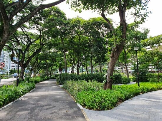
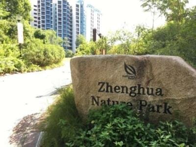
Zhenghua Nature Park is located in Bukit Panjang. Skirting the Central Catchment Nature Reserve, the nature park serves as a green buffer for the reserve.
The 13.5 hectare linear Zhenghua Nature Park was completed in 2002 and stretches for about 2.5 km along the BKE, linking the Bukit Panjang Park Connector to Bukit Timah Nature Reserve. A 3.8 hectare extension was opened in November 2015, bringing the total area of Zhenghua Nature Park to 17.3 hectares.
The nature park is part of our holistic approach to strengthen the conservation of the biodiversity of our nature reserves. By forming a vital ecological linkage between nature reserves and forested areas in the west like the Western Catchment, it facilitates the safe passage of fauna among green spaces. Such buffers thus function as extensions of the Reserve.
A wide variety of plants was introduced to the extension to provide more opportunities for the community to appreciate biodiversity. As part of habitat enhancement efforts, certain native plant species have been incorporated to provide ecological services to the surrounding fauna. Among these were bird and butterfly-attracting plants such as the Tembusu and Jejawi.
As a result of its linkage to the nature reserve and its diverse species of plants, high biodiversity can be observed in the park. 37 bird species which have been spotted at the park include the Olive-backed Sunbird, Flameback Woodpecker, Pink-necked Green Pigeon, Greater Racket-tailed Drongo and Long-tailed Parakeet. Long-tailed macaques, squirrels, monitor lizards and many others are a common sight in the park.
Facilities in the park include a multi-purpose event lawn, a children’s play area, an exercise station, a pavilion, public toilets, shelters, as well as jogging and cycling tracks.
Reviews (from Tripadvisor):
kim buay p
A park which connects many hiking trails
This is a linear park running parallel to the Bukit Timah Expressway. However the tall trees along the park block out the noise from the expressway. In fact this park is lovely for the numerous, tall and mature trees lining both sides of the jogging path. It is about 2.5 km long. It provides a venue for the residents to enjoy and exercise in the outdoors. It also serves to connect the Bukit Timah Nature Reserve with the various Chestnut trails. It also connects to the Bukit Panjang Park Connector which also leads to Pang Sua Pond. It also provides access to the Gansa Trail which ends in Mandai Road.
Opening Hours:
- 24 hours Daily
Price of Admission: Free Admission
Location & Address: 466 Segar Rd, Singapore 670466
Contact: 1800 471 3700
Website: Website Link Here
#10 – Changi Jurassic Mile
Introduction:
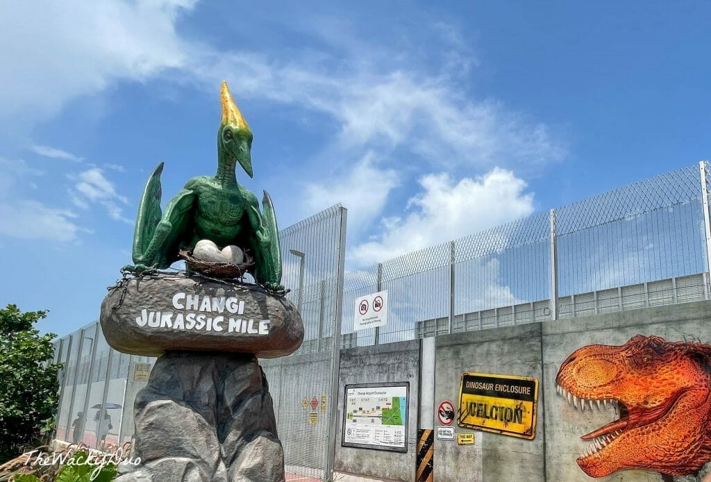
Jurassic Mile is Singapore’s newest and largest permanent outdoor display of life-sized dinosaurs. More than 20 different pre-historic creatures from nine different species stretch over 1-kilometre of the cycling and jogging path. Expect to see carnivorous and herbivorous species, defensive dinosaurs, as well as those that fly. The tallest dinosaur stands at almost 5 meters high!
Reviews (from Tripadvisor):
maryyeo
Best timing to visit, Be prepared to walk 5 kilometers, Fun walk on the way back
Best timing to visit:
If you’re worried about the crowd, visit on a weekday evening like us. Best to arrive at Terminal 4 at around 6pm or slightly earlier, so that you can complete the walk by around 7pm in order to catch the gorgeous sunset on the link bridge later on.
Be prepared to walk 5 kilometers:
While the Jurassic Mile attraction itself is only around 2 kilometers long, but you got to add the walk from Terminal 4 BEFORE arriving at the start of the mile, and since there isn’t really a way out the other way, you got to walk the entire 2 kilometers back to the start and add the walk back to Terminal 4 AFTER completion. Since we wanted to take a bus, we walked another kilometer or so to get to the bus stop on the “opposite direction”. Yes, that bus stop is really that far away, mainly because of the multi-lane highways leading to and out of the airport.
Fun walk on the way back (TOWARDS CHANGI JEWEL):
There were some pretty sights along that final stretch of walking, such as a mini “iLight” colour-changing balls on the grounds, I believe near Hub & Spoke cafe? The linkway overhead bridge, thankfully, has lifts on both ends so we did not have to lift the pram up the stairs. Time your walk in such a way that you get to view the gorgeous sunset at around 7pm on the bridge, overlooking SATS’ expansive building.
Opening Hours:
- 24 hours Daily
Price of Admission: Free Admission
Location & Address: Singapore Changi Airport
Contact: +65 6595 6865
Website: Website Link Here

Have a Place to Recommend?
Your contribution is valuable to us! Are there any outstanding businesses that you believe should be added to our list? If so, please send your recommendations to us at [email protected]. Tropika Club will review your suggestions and update the list accordingly. Thank you for your help in making our list of businesses as comprehensive and accurate as possible.
Meanwhile, Check out Tropika Club’s Ecosystem of Websites

Tropika Club Magazine – Tropika Club Magazine is a Singapore-based publication that features articles on a wide range of topics with a focus on local businesses and content for the region. The magazine emphasizes supporting local businesses through its #SupportLocal initiative, which includes coverage of everything from neighborhood hawker stalls to aesthetic clinics in town. In addition to highlighting local businesses, Tropika Club Magazine also covers a variety of local content, including beauty, lifestyle, places, eats, and what’s on in Singapore and the Asia Pacific region.
Tropika Club Deals – Tropika Club Deals is a leading online deals and voucher shopping site in Singapore, offering amazing discounts on beauty, wellness, and fitness products and services. It’s the perfect platform for customers who want to discover the best deals without having to commit to a specific appointment date and time. These deals are available at major beauty stores, facial salons, hair salons, and other brands in Singapore, with no minimum spend required. Choose from guaranteed discounted deals in the categories of hairstyling, hair removal, facial & aesthetics, body slimming, brows & lashes, nails & makeup, massage & spa or fitness & wellness. Tropika Club Deals is also ideal for customers who want to buy vouchers as gifts or to use for the future. So whether you’re looking to save money on your next haircut or want to treat yourself to a relaxing massage, Tropika Club Deals has got you covered with the best voucher and coupon deals in Singapore!


